


Aubrac st Come d'olt st Jacques

guariso
User
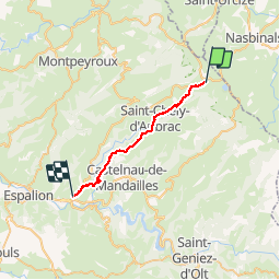

Length
24 km

Max alt
1319 m

Uphill gradient
319 m
Km-Effort
31 km

Min alt
388 m

Downhill gradient
1246 m
Boucle
No
Creation date :
2019-05-07 06:41:18.199
Updated on :
2019-05-07 15:58:34.973
7h00
Difficulty : Difficult

FREE GPS app for hiking
 SityTrail
IGN / Geographical institutes
SityTrail Plus
The world is yours!
About
Trail Walking of 24 km to be discovered at Occitania, Aveyron, Saint-Chély-d'Aubrac. This trail is proposed by guariso.
Description
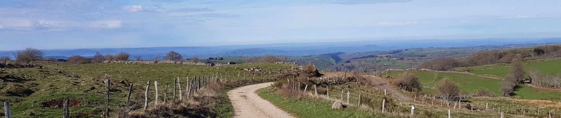
1250m de dénivelé descendant. jolis paysages
Photos


Positioning
Country:
France
Region :
Occitania
Department/Province :
Aveyron
Municipality :
Saint-Chély-d'Aubrac
Location:
Unknown
Start:(Dec)
Start:(UTM)
498863 ; 4940932 (31T) N.
Comments