


Baille

CANON2
User

Length
14.9 km

Max alt
121 m

Uphill gradient
111 m
Km-Effort
16.4 km

Min alt
74 m

Downhill gradient
113 m
Boucle
Yes
Creation date :
2019-05-15 13:09:39.309
Updated on :
2019-05-15 13:09:39.351
3h37
Difficulty : Easy

FREE GPS app for hiking
 SityTrail
IGN / Geographical institutes
SityTrail Plus
The world is yours!
About
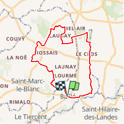
Trail Walking of 14.9 km to be discovered at Brittany, Ille-et-Vilaine, Saint-Marc-le-Blanc. This trail is proposed by CANON2.
Description
pas balisé
Positioning
Country:
France
Region :
Brittany
Department/Province :
Ille-et-Vilaine
Municipality :
Saint-Marc-le-Blanc
Location:
Baillé
Start:(Dec)
Start:(UTM)
619951 ; 5357518 (30U) N.
Comments