


Fourneby

verotrail
User
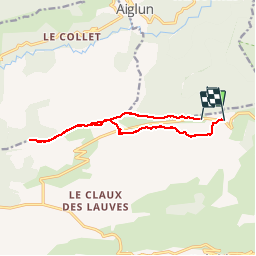

Length
12.2 km

Max alt
1590 m

Uphill gradient
413 m
Km-Effort
17.7 km

Min alt
1361 m

Downhill gradient
388 m
Boucle
No
Creation date :
2019-05-07 07:51:43.472
Updated on :
2019-05-09 07:43:15.64
5h12
Difficulty : Medium

FREE GPS app for hiking
 SityTrail
IGN / Geographical institutes
SityTrail Plus
The world is yours!
About
Trail Walking of 12.2 km to be discovered at Provence-Alpes-Côte d'Azur, Maritime Alps, Gréolières. This trail is proposed by verotrail.
Positioning
Country:
France
Region :
Provence-Alpes-Côte d'Azur
Department/Province :
Maritime Alps
Municipality :
Gréolières
Location:
Unknown
Start:(Dec)
Start:(UTM)
334145 ; 4855064 (32T) N.
Comments