


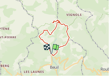
Mont Moulines en boucle depuis Beuil

aris
User

Length
12.9 km

Max alt
2072 m

Uphill gradient
788 m
Km-Effort
23 km

Min alt
1440 m

Downhill gradient
790 m
Boucle
Yes
Creation date :
2019-05-11 07:32:58.971
Updated on :
2020-06-07 07:25:01.21
6h05
Difficulty : Medium

FREE GPS app for hiking
 SityTrail
IGN / Geographical institutes
SityTrail Plus
The world is yours!
About
Trail Walking of 12.9 km to be discovered at Provence-Alpes-Côte d'Azur, Maritime Alps, Beuil. This trail is proposed by aris.
Description
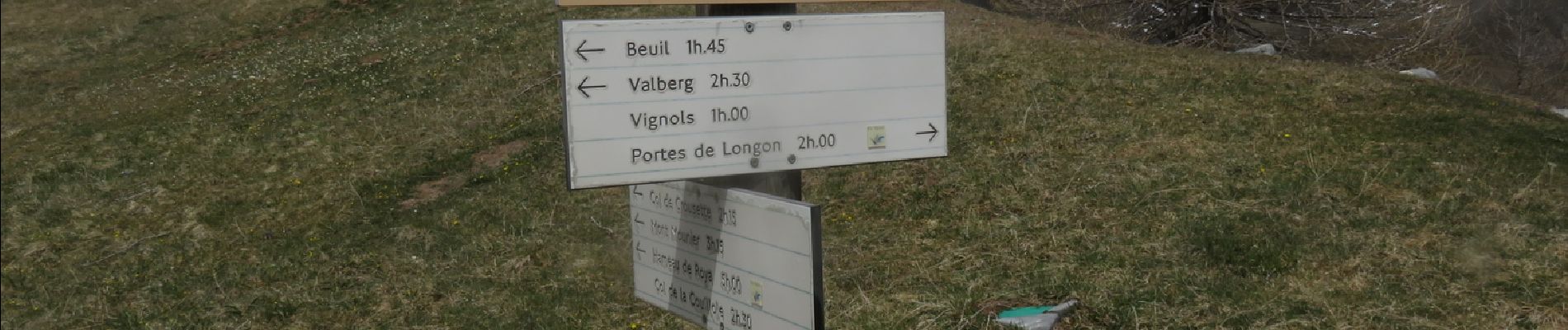
Belles vues dégagées sur les sommets enneigés (Mounier, dome de Barrot...)
Photos


Positioning
Country:
France
Region :
Provence-Alpes-Côte d'Azur
Department/Province :
Maritime Alps
Municipality :
Beuil
Location:
Unknown
Start:(Dec)
Start:(UTM)
338901 ; 4885537 (32T) N.
Comments