


mongresin 1

Pousscailleux
User
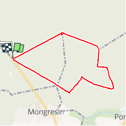

Length
7.3 km

Max alt
74 m

Uphill gradient
46 m
Km-Effort
7.9 km

Min alt
59 m

Downhill gradient
45 m
Boucle
Yes
Creation date :
2019-05-12 06:49:31.183
Updated on :
2019-05-12 08:56:29.654
2h05
Difficulty : Very easy

FREE GPS app for hiking
 SityTrail
IGN / Geographical institutes
SityTrail Plus
The world is yours!
About
Trail Walking of 7.3 km to be discovered at Hauts-de-France, Oise, Avilly-Saint-Léonard. This trail is proposed by Pousscailleux.
Positioning
Country:
France
Region :
Hauts-de-France
Department/Province :
Oise
Municipality :
Avilly-Saint-Léonard
Location:
Unknown
Start:(Dec)
Start:(UTM)
464185 ; 5446108 (31U) N.
Comments