


Du Col de Valouse à la montagne de Mielandre

ajasse
User
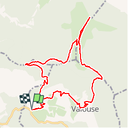

Length
12.1 km

Max alt
1442 m

Uphill gradient
812 m
Km-Effort
23 km

Min alt
710 m

Downhill gradient
813 m
Boucle
Yes
Creation date :
2019-05-13 07:35:58.815
Updated on :
2019-05-13 17:38:39.019
6h21
Difficulty : Very difficult

FREE GPS app for hiking
 SityTrail
IGN / Geographical institutes
SityTrail Plus
The world is yours!
About
Trail Walking of 12.1 km to be discovered at Auvergne-Rhône-Alpes, Drôme, Valouse. This trail is proposed by ajasse.
Description
Randonnée difficile, dénivelé important.
Montée et descente très raides.
Positioning
Country:
France
Region :
Auvergne-Rhône-Alpes
Department/Province :
Drôme
Municipality :
Valouse
Location:
Unknown
Start:(Dec)
Start:(UTM)
673128 ; 4925501 (31T) N.
Comments