


Bois Français

maupassant38
User
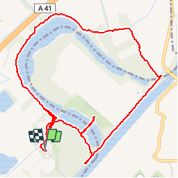

Length
6.7 km

Max alt
234 m

Uphill gradient
59 m
Km-Effort
7.5 km

Min alt
218 m

Downhill gradient
59 m
Boucle
Yes
Creation date :
2019-05-18 08:43:46.445
Updated on :
2019-05-18 18:24:23.58
2h09
Difficulty : Easy

FREE GPS app for hiking
 SityTrail
IGN / Geographical institutes
SityTrail Plus
The world is yours!
About
Trail Walking of 6.7 km to be discovered at Auvergne-Rhône-Alpes, Isère, Saint-Ismier. This trail is proposed by maupassant38.
Positioning
Country:
France
Region :
Auvergne-Rhône-Alpes
Department/Province :
Isère
Municipality :
Saint-Ismier
Location:
Unknown
Start:(Dec)
Start:(UTM)
722858 ; 5011716 (31T) N.
Comments