


04 GTMC St Flour-Pompeyrin

nicolas54230
User

Length
58 km

Max alt
1494 m

Uphill gradient
1479 m
Km-Effort
77 km

Min alt
764 m

Downhill gradient
1205 m
Boucle
No
Creation date :
2019-05-19 13:39:33.416
Updated on :
2019-05-19 14:13:28.423
32m
Difficulty : Easy

FREE GPS app for hiking
 SityTrail
IGN / Geographical institutes
SityTrail Plus
The world is yours!
About
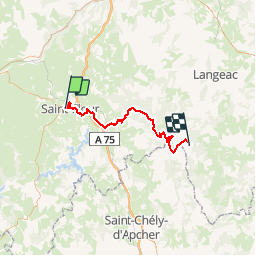
Trail Mountain bike of 58 km to be discovered at Auvergne-Rhône-Alpes, Cantal, Saint-Flour. This trail is proposed by nicolas54230.
Positioning
Country:
France
Region :
Auvergne-Rhône-Alpes
Department/Province :
Cantal
Municipality :
Saint-Flour
Location:
Unknown
Start:(Dec)
Start:(UTM)
506489 ; 4986621 (31T) N.
Comments