


la courteix saint Pierre le chastel

jeanic63
User
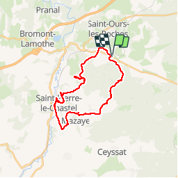

Length
26 km

Max alt
846 m

Uphill gradient
417 m
Km-Effort
31 km

Min alt
674 m

Downhill gradient
416 m
Boucle
Yes
Creation date :
2019-05-20 06:15:37.984
Updated on :
2019-05-20 19:21:25.886
6h59
Difficulty : Medium

FREE GPS app for hiking
 SityTrail
IGN / Geographical institutes
SityTrail Plus
The world is yours!
About
Trail Walking of 26 km to be discovered at Auvergne-Rhône-Alpes, Puy-de-Dôme, Saint-Ours. This trail is proposed by jeanic63.
Description
parking de la courteix
Positioning
Country:
France
Region :
Auvergne-Rhône-Alpes
Department/Province :
Puy-de-Dôme
Municipality :
Saint-Ours
Location:
Unknown
Start:(Dec)
Start:(UTM)
491900 ; 5075214 (31T) N.
Comments