


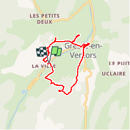
Autour de Gresse-en-Vercors

maupassant38
User

Length
8 km

Max alt
1321 m

Uphill gradient
216 m
Km-Effort
10.9 km

Min alt
1187 m

Downhill gradient
217 m
Boucle
Yes
Creation date :
2019-05-21 09:05:19.154
Updated on :
2019-05-21 17:29:25.153
2h21
Difficulty : Easy

FREE GPS app for hiking
 SityTrail
IGN / Geographical institutes
SityTrail Plus
The world is yours!
About
Trail Walking of 8 km to be discovered at Auvergne-Rhône-Alpes, Isère, Gresse-en-Vercors. This trail is proposed by maupassant38.
Positioning
Country:
France
Region :
Auvergne-Rhône-Alpes
Department/Province :
Isère
Municipality :
Gresse-en-Vercors
Location:
Unknown
Start:(Dec)
Start:(UTM)
701723 ; 4974806 (31T) N.
Comments