


Pivoines Sederon

jcboutin
User

Length
19.3 km

Max alt
1447 m

Uphill gradient
799 m
Km-Effort
30 km

Min alt
803 m

Downhill gradient
798 m
Boucle
Yes
Creation date :
2019-05-23 07:52:37.984
Updated on :
2019-05-23 17:02:53.236
6h04
Difficulty : Medium

FREE GPS app for hiking
 SityTrail
IGN / Geographical institutes
SityTrail Plus
The world is yours!
About
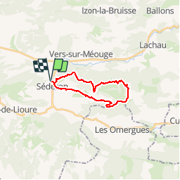
Trail Walking of 19.3 km to be discovered at Auvergne-Rhône-Alpes, Drôme, Séderon. This trail is proposed by jcboutin.
Photos


Positioning
Country:
France
Region :
Auvergne-Rhône-Alpes
Department/Province :
Drôme
Municipality :
Séderon
Location:
Unknown
Start:(Dec)
Start:(UTM)
702667 ; 4897846 (31T) N.
Comments