


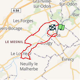
Gavrus via le locheur

rollondesbois
User

Length
13.8 km

Max alt
97 m

Uphill gradient
191 m
Km-Effort
16.4 km

Min alt
50 m

Downhill gradient
189 m
Boucle
Yes
Creation date :
2019-05-25 21:00:17.178
Updated on :
2019-05-25 21:01:14.438
3h34
Difficulty : Difficult

FREE GPS app for hiking
 SityTrail
IGN / Geographical institutes
SityTrail Plus
The world is yours!
About
Trail Walking of 13.8 km to be discovered at Normandy, Calvados, Gavrus. This trail is proposed by rollondesbois.
Positioning
Country:
France
Region :
Normandy
Department/Province :
Calvados
Municipality :
Gavrus
Location:
Unknown
Start:(Dec)
Start:(UTM)
681445 ; 5443537 (30U) N.
Comments