


Ferme de Beuvardelle La Tournelle

avdem
User
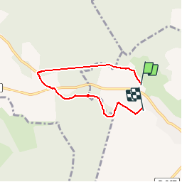

Length
4.8 km

Max alt
203 m

Uphill gradient
103 m
Km-Effort
6.1 km

Min alt
121 m

Downhill gradient
86 m
Boucle
No
Creation date :
2019-05-26 07:08:10.732
Updated on :
2019-05-27 07:32:13.456
1h18
Difficulty : Very easy

FREE GPS app for hiking
 SityTrail
IGN / Geographical institutes
SityTrail Plus
The world is yours!
About
Trail Walking of 4.8 km to be discovered at Hauts-de-France, Aisne, Beuvardes. This trail is proposed by avdem.
Description
Facile
Positioning
Country:
France
Region :
Hauts-de-France
Department/Province :
Aisne
Municipality :
Beuvardes
Location:
Unknown
Start:(Dec)
Start:(UTM)
534493 ; 5443764 (31U) N.
Comments