23-MAI-19 12.08.22

rigol05
User
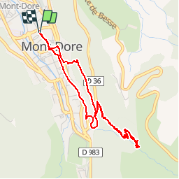

Length
4.7 km

Max alt
1321 m

Uphill gradient
281 m
Km-Effort
8.4 km

Min alt
1027 m

Downhill gradient
281 m
Boucle
Yes
Creation date :
2019-05-28 09:07:50.91
Updated on :
2019-05-28 09:15:27.228
--
Difficulty : Easy

FREE GPS app for hiking
 SityTrail
IGN / Geographical institutes
SityTrail Plus
The world is yours!
About
Trail Walking of 4.7 km to be discovered at Auvergne-Rhône-Alpes, Puy-de-Dôme, Mont-Dore. This trail is proposed by rigol05.
Description
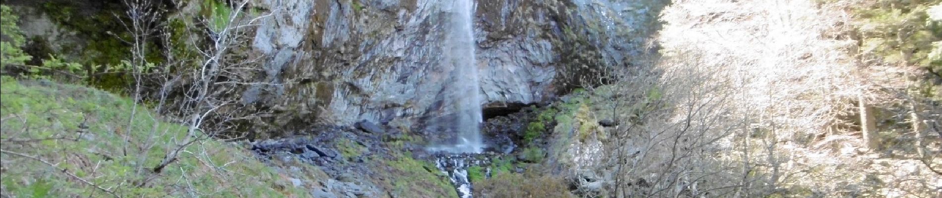
Balade classique entièrement balisée.
Photos

Positioning
Country:
France
Region :
Auvergne-Rhône-Alpes
Department/Province :
Puy-de-Dôme
Municipality :
Mont-Dore
Location:
Unknown
Start:(Dec)
Start:(UTM)
485023 ; 5046975 (31T) N.
Comments