


camponells avecla neige

leroj73
User
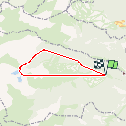

Length
11.2 km

Max alt
2356 m

Uphill gradient
898 m
Km-Effort
23 km

Min alt
1753 m

Downhill gradient
899 m
Boucle
Yes
Creation date :
2019-05-30 09:10:42.381
Updated on :
2019-05-30 14:29:36.976
4h40
Difficulty : Medium

FREE GPS app for hiking
 SityTrail
IGN / Geographical institutes
SityTrail Plus
The world is yours!
About
Trail Walking of 11.2 km to be discovered at Occitania, Pyrénées-Orientales, Formiguères. This trail is proposed by leroj73.
Positioning
Country:
France
Region :
Occitania
Department/Province :
Pyrénées-Orientales
Municipality :
Formiguères
Location:
Unknown
Start:(Dec)
Start:(UTM)
423775 ; 4719444 (31T) N.
Comments