


Randonnée et bateau Grimaud

henriantoine
User
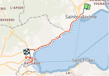

Length
14.9 km

Max alt
51 m

Uphill gradient
81 m
Km-Effort
16.2 km

Min alt
0 m

Downhill gradient
126 m
Boucle
No
Creation date :
2019-05-30 11:52:32.0
Updated on :
2020-01-11 15:15:54.107
3h29
Difficulty : Unknown

FREE GPS app for hiking
 SityTrail
IGN / Geographical institutes
SityTrail Plus
The world is yours!
About
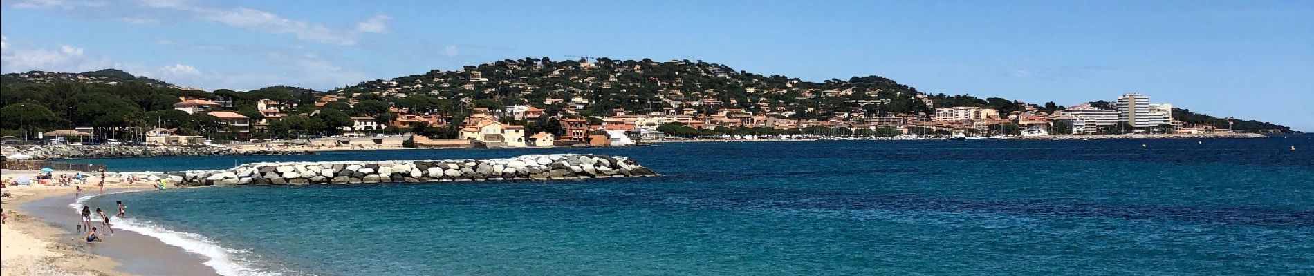
Trail Walking of 14.9 km to be discovered at Provence-Alpes-Côte d'Azur, Var, Sainte-Maxime. This trail is proposed by henriantoine.
Photos


28 photos in total. Please click on a photo to see them all in the gallery.
Positioning
Country:
France
Region :
Provence-Alpes-Côte d'Azur
Department/Province :
Var
Municipality :
Sainte-Maxime
Location:
Unknown
Start:(Dec)
Start:(UTM)
308613 ; 4798118 (32T) N.
Comments