


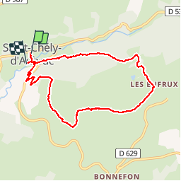
St Chely d'Aubrac - la voie romaine

mysterdub
User

Length
8.7 km

Max alt
1110 m

Uphill gradient
328 m
Km-Effort
13.1 km

Min alt
790 m

Downhill gradient
351 m
Boucle
No
Creation date :
2019-05-31 08:33:19.272
Updated on :
2019-07-05 20:40:35.61
4h05
Difficulty : Very easy

FREE GPS app for hiking
 SityTrail
IGN / Geographical institutes
SityTrail Plus
The world is yours!
About
Trail Walking of 8.7 km to be discovered at Occitania, Aveyron, Saint-Chély-d'Aubrac. This trail is proposed by mysterdub.
Positioning
Country:
France
Region :
Occitania
Department/Province :
Aveyron
Municipality :
Saint-Chély-d'Aubrac
Location:
Unknown
Start:(Dec)
Start:(UTM)
493757 ; 4937460 (31T) N.
Comments