


arbre quenouille

denel
User
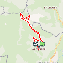

Length
8.8 km
Boucle
Yes
Creation date :
2019-05-31 13:15:06.357
Updated on :
2019-05-31 16:50:14.5
3h33
Difficulty : Very easy

FREE GPS app for hiking
 SityTrail
IGN / Geographical institutes
SityTrail Plus
The world is yours!
About
Trail Walking of 8.8 km to be discovered at Auvergne-Rhône-Alpes, Cantal, Vic-sur-Cère. This trail is proposed by denel.
Positioning
Country:
France
Region :
Auvergne-Rhône-Alpes
Department/Province :
Cantal
Municipality :
Vic-sur-Cère
Location:
Unknown
Start:(Dec)
Start:(UTM)
469884 ; 4981572 (31T) N.
Comments