


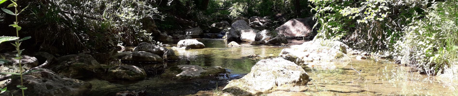
gorge de Penafore

marmotte83
User
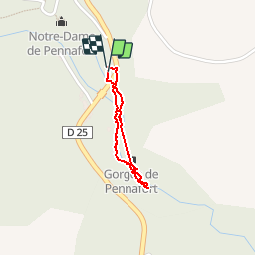

Length
1.1 km

Max alt
177 m

Uphill gradient
14 m
Km-Effort
1.3 km

Min alt
162 m

Downhill gradient
9 m
Boucle
Yes
Creation date :
2019-06-01 12:53:59.317
Updated on :
2019-06-01 14:57:46.011
1h33
Difficulty : Very easy

FREE GPS app for hiking
 SityTrail
IGN / Geographical institutes
SityTrail Plus
The world is yours!
About
Trail Walking of 1.1 km to be discovered at Provence-Alpes-Côte d'Azur, Var, Callas. This trail is proposed by marmotte83.
Description
Balade le long de la rivière. Balade rafraîchissante.
Photos


Positioning
Country:
France
Region :
Provence-Alpes-Côte d'Azur
Department/Province :
Var
Municipality :
Callas
Location:
Unknown
Start:(Dec)
Start:(UTM)
303997 ; 4824501 (32T) N.
Comments
Chemin de randonnée inexistant par endroit. Accessibilité difficile. Imprécision du circuit amenant au lit du cours d'eau sans possibilité de continuer. Le circuit, au bout de 150 mètres aboutit dans une propriété privée dont il faut s'extraire en franchissant une clôture en barbelés. L'office de tourisme de Callas nous avait précisé qu'il n'y avait pas de circuit de randonnée. ...ils avaient raison. Donner cette randonnée comme étant très facile est une erreur grave. A déconseiller fortement. Souvenir inoubliable garanti.