


grotte ND de Lourdes et Cascades

COMAN
User
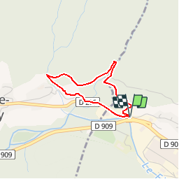

Length
2.6 km

Max alt
798 m

Uphill gradient
210 m
Km-Effort
5.4 km

Min alt
584 m

Downhill gradient
217 m
Boucle
Yes
Creation date :
2019-06-02 12:50:29.206
Updated on :
2019-06-02 12:52:22.138
1h04
Difficulty : Easy

FREE GPS app for hiking
 SityTrail
IGN / Geographical institutes
SityTrail Plus
The world is yours!
About
Trail Walking of 2.6 km to be discovered at Auvergne-Rhône-Alpes, Upper Savoy, Thônes. This trail is proposed by COMAN.
Description
Petit circuit découverte aux abords de Thones
Positioning
Country:
France
Region :
Auvergne-Rhône-Alpes
Department/Province :
Upper Savoy
Municipality :
Thônes
Location:
Unknown
Start:(Dec)
Start:(UTM)
289926 ; 5086472 (32T) N.
Comments