


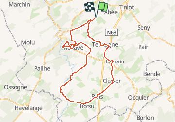
Ramelot - Clavier - Hoyoux - Modave - Ramelot

bncg
User

Length
33 km

Max alt
320 m

Uphill gradient
375 m
Km-Effort
38 km

Min alt
202 m

Downhill gradient
375 m
Boucle
Yes
Creation date :
2014-12-10 00:00:00.0
Updated on :
2014-12-10 00:00:00.0
2h11
Difficulty : Easy

FREE GPS app for hiking
 SityTrail
IGN / Geographical institutes
SityTrail Plus
The world is yours!
About
Trail Cycle of 33 km to be discovered at Wallonia, Liège, Tinlot. This trail is proposed by bncg.
Positioning
Country:
Belgium
Region :
Wallonia
Department/Province :
Liège
Municipality :
Tinlot
Location:
Ramelot
Start:(Dec)
Start:(UTM)
665761 ; 5593288 (31U) N.
Comments