


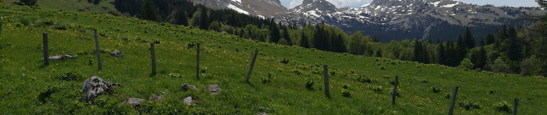
La Conversaria - Sentier Gobert

maupassant38
User

Length
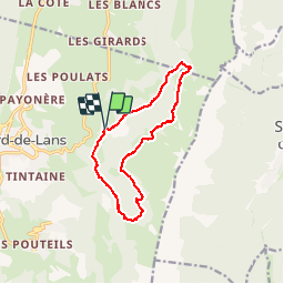
12.8 km

Max alt
1565 m

Uphill gradient
482 m
Km-Effort
19.2 km

Min alt
1165 m

Downhill gradient
481 m
Boucle
Yes
Creation date :
2019-06-03 07:59:41.316
Updated on :
2019-06-03 14:56:16.126
3h43
Difficulty : Medium

FREE GPS app for hiking
 SityTrail
IGN / Geographical institutes
SityTrail Plus
The world is yours!
About
Trail Walking of 12.8 km to be discovered at Auvergne-Rhône-Alpes, Isère, Villard-de-Lans. This trail is proposed by maupassant38.
Photos


Positioning
Country:
France
Region :
Auvergne-Rhône-Alpes
Department/Province :
Isère
Municipality :
Villard-de-Lans
Location:
Unknown
Start:(Dec)
Start:(UTM)
703037 ; 4994304 (31T) N.
Comments