


Randonnée de la Bastide Puylaurens à la Garde Guérin

ajasse
User

Length
20 km

Max alt
1141 m

Uphill gradient
443 m
Km-Effort
26 km

Min alt
800 m

Downhill gradient
598 m
Boucle
No
Creation date :
2019-06-03 08:00:45.229
Updated on :
2019-06-04 08:51:11.296
6h19
Difficulty : Difficult

FREE GPS app for hiking
 SityTrail
IGN / Geographical institutes
SityTrail Plus
The world is yours!
About
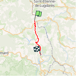
Trail Walking of 20 km to be discovered at Occitania, Lozère, La Bastide-Puylaurent. This trail is proposed by ajasse.
Description
départ de la Gare de la Bastide Puylaurent en direction de la Garde Guérin.
Petit détour par Prevencheres.
Ne pas manquer le belvédère à la Garde Guérin ainsi que l'a visite du village.
Photos

Positioning
Country:
France
Region :
Occitania
Department/Province :
Lozère
Municipality :
La Bastide-Puylaurent
Location:
Unknown
Start:(Dec)
Start:(UTM)
571784 ; 4938198 (31T) N.
Comments