


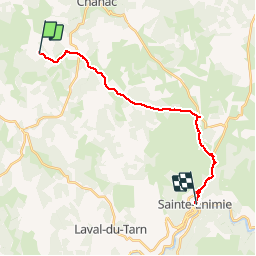
St Guilhem 6 - Le Gazy à St Enimie

mysterdub
User

Length
19.4 km

Max alt
974 m

Uphill gradient
268 m
Km-Effort
24 km

Min alt
475 m

Downhill gradient
650 m
Boucle
No
Creation date :
2019-06-04 06:39:00.244
Updated on :
2019-07-05 20:43:48.965
5h46
Difficulty : Very easy

FREE GPS app for hiking
 SityTrail
IGN / Geographical institutes
SityTrail Plus
The world is yours!
About
Trail Walking of 19.4 km to be discovered at Occitania, Lozère, Chanac. This trail is proposed by mysterdub.
Positioning
Country:
France
Region :
Occitania
Department/Province :
Lozère
Municipality :
Chanac
Location:
Chanac
Start:(Dec)
Start:(UTM)
524131 ; 4920812 (31T) N.
Comments