


190604-franchard

randodan
User
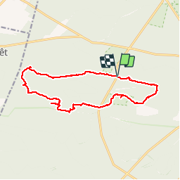

Length
14.8 km

Max alt
140 m

Uphill gradient
176 m
Km-Effort
17.1 km

Min alt
84 m

Downhill gradient
177 m
Boucle
Yes
Creation date :
2019-06-04 07:44:26.629
Updated on :
2019-06-04 14:45:13.904
6h59
Difficulty : Very easy

FREE GPS app for hiking
 SityTrail
IGN / Geographical institutes
SityTrail Plus
The world is yours!
About
Trail Walking of 14.8 km to be discovered at Ile-de-France, Seine-et-Marne, Fontainebleau. This trail is proposed by randodan.
Positioning
Country:
France
Region :
Ile-de-France
Department/Province :
Seine-et-Marne
Municipality :
Fontainebleau
Location:
Unknown
Start:(Dec)
Start:(UTM)
473240 ; 5361304 (31U) N.
Comments