


20190605-Amiens

doudet
User

Length
20 km

Max alt
62 m

Uphill gradient
144 m
Km-Effort
22 km

Min alt
12 m

Downhill gradient
143 m
Boucle
Yes
Creation date :
2019-06-05 08:23:51.397
Updated on :
2019-06-18 06:33:53.347
5h20
Difficulty : Easy

FREE GPS app for hiking
 SityTrail
IGN / Geographical institutes
SityTrail Plus
The world is yours!
About
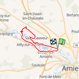
Trail Walking of 20 km to be discovered at Hauts-de-France, Somme, Amiens. This trail is proposed by doudet.
Description
Boucle A-R
Positioning
Country:
France
Region :
Hauts-de-France
Department/Province :
Somme
Municipality :
Amiens
Location:
Unknown
Start:(Dec)
Start:(UTM)
446893 ; 5530275 (31U) N.
Comments