


16 EUVILLE Carriére AMl: 07 AVR 2014 14:03

ZAMBAUX
User

Length
17.2 km

Max alt
368 m

Uphill gradient
335 m
Km-Effort
22 km

Min alt
279 m

Downhill gradient
334 m
Boucle
Yes
Creation date :
2019-06-05 20:45:36.803
Updated on :
2019-06-05 20:48:14.335
4h39
Difficulty : Very difficult

FREE GPS app for hiking
 SityTrail
IGN / Geographical institutes
SityTrail Plus
The world is yours!
About
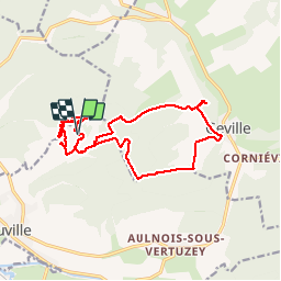
Trail Walking of 17.2 km to be discovered at Grand Est, Meuse, Euville. This trail is proposed by ZAMBAUX.
Positioning
Country:
France
Region :
Grand Est
Department/Province :
Meuse
Municipality :
Euville
Location:
Unknown
Start:(Dec)
Start:(UTM)
694452 ; 5405212 (31U) N.
Comments