


fontan ceva

fab4u
User
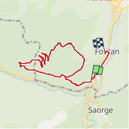

Length
10.4 km

Max alt
963 m

Uphill gradient
556 m
Km-Effort
17.9 km

Min alt
412 m

Downhill gradient
584 m
Boucle
No
Creation date :
2019-06-07 07:55:45.523
Updated on :
2019-06-08 14:01:43.186
4h56
Difficulty : Medium

FREE GPS app for hiking
 SityTrail
IGN / Geographical institutes
SityTrail Plus
The world is yours!
About
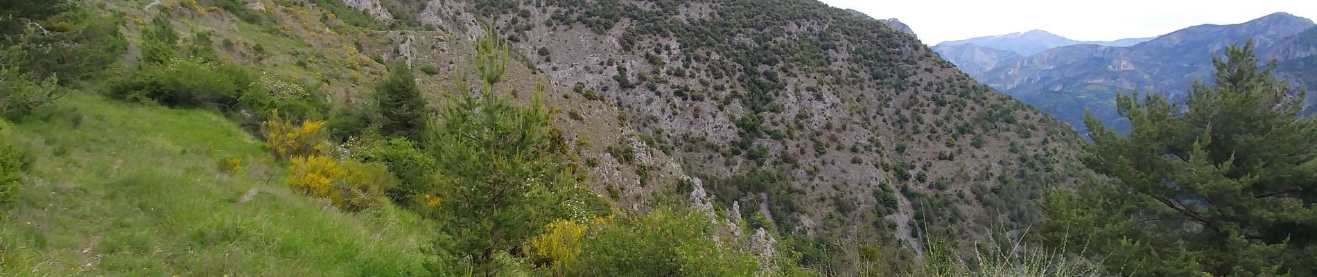
Trail Walking of 10.4 km to be discovered at Provence-Alpes-Côte d'Azur, Maritime Alps, Fontan. This trail is proposed by fab4u.
Photos

Positioning
Country:
France
Region :
Provence-Alpes-Côte d'Azur
Department/Province :
Maritime Alps
Municipality :
Fontan
Location:
Unknown
Start:(Dec)
Start:(UTM)
383616 ; 4872381 (32T) N.
Comments