


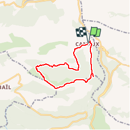
Montagne du Thiey sens des aiguilles d'une montre 3542 ET

verotrail
User

Length
12.3 km

Max alt
1544 m

Uphill gradient
534 m
Km-Effort
19.5 km

Min alt
1071 m

Downhill gradient
534 m
Boucle
Yes
Creation date :
2019-06-10 12:05:14.772
Updated on :
2019-09-02 16:30:21.19
--
Difficulty : Medium

FREE GPS app for hiking
 SityTrail
IGN / Geographical institutes
SityTrail Plus
The world is yours!
About
Trail On foot of 12.3 km to be discovered at Provence-Alpes-Côte d'Azur, Maritime Alps, Andon. This trail is proposed by verotrail.
Positioning
Country:
France
Region :
Provence-Alpes-Côte d'Azur
Department/Province :
Maritime Alps
Municipality :
Andon
Location:
Unknown
Start:(Dec)
Start:(UTM)
327869 ; 4846661 (32T) N.
Comments
joli parcours