


2019-06-11 13:14:39

boularand
User
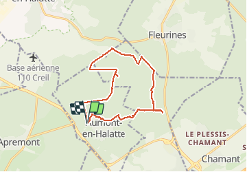

Length
13.7 km

Max alt
148 m

Uphill gradient
189 m
Km-Effort
16.2 km

Min alt
93 m

Downhill gradient
187 m
Boucle
Yes
Creation date :
2019-06-11 20:10:44.494
Updated on :
2019-06-11 20:13:55.366
3h32
Difficulty : Difficult

FREE GPS app for hiking
 SityTrail
IGN / Geographical institutes
SityTrail Plus
The world is yours!
About
Trail Walking of 13.7 km to be discovered at Hauts-de-France, Oise, Aumont-en-Halatte. This trail is proposed by boularand.
Description
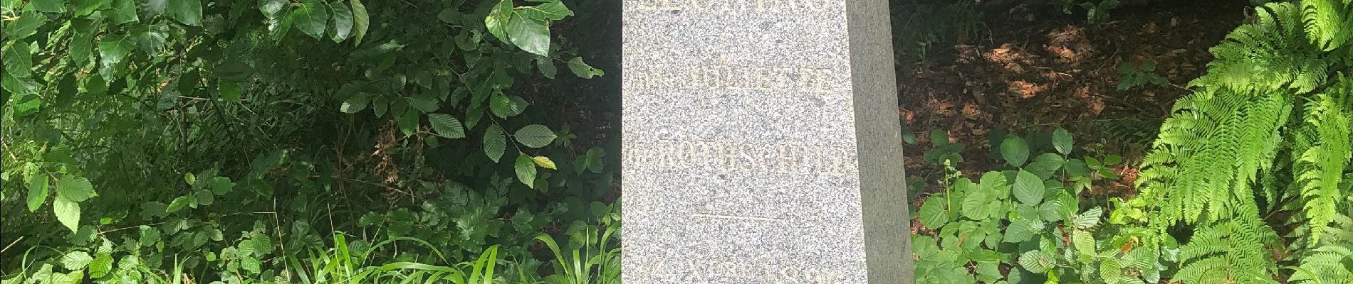
Belle rando en sous bois avec deux points à voir
Photos


Positioning
Country:
France
Region :
Hauts-de-France
Department/Province :
Oise
Municipality :
Aumont-en-Halatte
Location:
Unknown
Start:(Dec)
Start:(UTM)
466959 ; 5453232 (31U) N.
Comments