


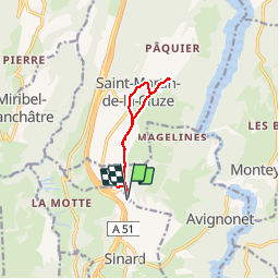
Avignonet La Mairie - St Martin de la Cluze

maupassant38
User

Length
8.6 km

Max alt
821 m

Uphill gradient
178 m
Km-Effort
11 km

Min alt
676 m

Downhill gradient
178 m
Boucle
Yes
Creation date :
2019-06-13 09:07:38.109
Updated on :
2019-06-13 18:57:59.416
2h04
Difficulty : Very easy

FREE GPS app for hiking
 SityTrail
IGN / Geographical institutes
SityTrail Plus
The world is yours!
About
Trail Walking of 8.6 km to be discovered at Auvergne-Rhône-Alpes, Isère, Avignonet. This trail is proposed by maupassant38.
Photos

Positioning
Country:
France
Region :
Auvergne-Rhône-Alpes
Department/Province :
Isère
Municipality :
Avignonet
Location:
Unknown
Start:(Dec)
Start:(UTM)
709515 ; 4981840 (31T) N.
Comments