SityTrail - 20190512-ober

thle
User
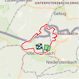

Length
10.9 km

Max alt
418 m

Uphill gradient
326 m
Km-Effort
15.2 km

Min alt
239 m

Downhill gradient
320 m
Boucle
Yes
Creation date :
2019-06-16 15:27:20.792
Updated on :
2019-06-16 15:59:07.712
--
Difficulty : Very easy

FREE GPS app for hiking
 SityTrail
IGN / Geographical institutes
SityTrail Plus
The world is yours!
About
Trail Equestrian of 10.9 km to be discovered at Grand Est, Bas-Rhin, Obersteinbach. This trail is proposed by thle.
Description
Petite balade autour d'Obersteinbach, avec visite du château du Wasigenstein. (Prévoir licol).
Positioning
Country:
France
Region :
Grand Est
Department/Province :
Bas-Rhin
Municipality :
Obersteinbach
Location:
Unknown
Start:(Dec)
Start:(UTM)
404324 ; 5432258 (32U) N.
Comments