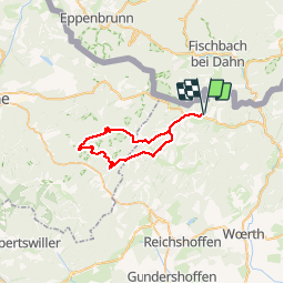
SityTrail - Obersteinbach - Falkenstein

thle
User

Length
34 km

Max alt
388 m

Uphill gradient
781 m
Km-Effort
45 km

Min alt
218 m

Downhill gradient
781 m
Boucle
Yes
Creation date :
2019-06-18 16:05:52.312
Updated on :
2019-06-18 16:29:07.875
--
Difficulty : Medium

FREE GPS app for hiking
 SityTrail
IGN / Geographical institutes
SityTrail Plus
The world is yours!
About
Trail Equestrian of 34 km to be discovered at Grand Est, Bas-Rhin, Obersteinbach. This trail is proposed by thle.
Positioning
Country:
France
Region :
Grand Est
Department/Province :
Bas-Rhin
Municipality :
Obersteinbach
Location:
Unknown
Start:(Dec)
Start:(UTM)
404579 ; 5432431 (32U) N.
Comments