


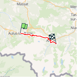
Gr10: Aulus-Goulier

petit-pied
User

Length
21 km

Max alt
1795 m

Uphill gradient
1425 m
Km-Effort
39 km

Min alt
738 m

Downhill gradient
1078 m
Boucle
No
Creation date :
2019-06-21 06:47:45.213
Updated on :
2019-06-21 20:25:24.542
5h52
Difficulty : Difficult

FREE GPS app for hiking
 SityTrail
IGN / Geographical institutes
SityTrail Plus
The world is yours!
About
Trail Walking of 21 km to be discovered at Occitania, Ariège, Aulus-les-Bains. This trail is proposed by petit-pied.
Positioning
Country:
France
Region :
Occitania
Department/Province :
Ariège
Municipality :
Aulus-les-Bains
Location:
Unknown
Start:(Dec)
Start:(UTM)
364166 ; 4739007 (31T) N.
Comments