


Le_Pas_du_Roc.kml

gregou74
User
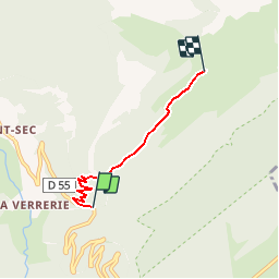

Length
3.6 km

Max alt
1409 m

Uphill gradient
484 m
Km-Effort
8.5 km

Min alt
930 m

Downhill gradient
35 m
Boucle
No
Creation date :
2019-06-22 20:28:37.135
Updated on :
2019-06-22 20:35:35.999
1h54
Difficulty : Medium

FREE GPS app for hiking
 SityTrail
IGN / Geographical institutes
SityTrail Plus
The world is yours!
About
Trail Walking of 3.6 km to be discovered at Auvergne-Rhône-Alpes, Upper Savoy, Fillière. This trail is proposed by gregou74.
Description
Converted from a KML file KML2GPX.COM


Positioning
Country:
France
Region :
Auvergne-Rhône-Alpes
Department/Province :
Upper Savoy
Municipality :
Fillière
Location:
Thorens-Glières
Start:(Dec)
Start:(UTM)
290738 ; 5094230 (32T) N.
Comments