


zorg

planets
User
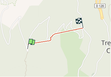

Length
727 m

Max alt
1335 m

Uphill gradient
0 m
Km-Effort
1.5 km

Min alt
1084 m

Downhill gradient
235 m
Boucle
No
Creation date :
2019-06-23 16:30:52.713
Updated on :
2019-06-23 17:02:37.457
31m
Difficulty : Very easy

FREE GPS app for hiking
 SityTrail
IGN / Geographical institutes
SityTrail Plus
The world is yours!
About
Trail Walking of 727 m to be discovered at Auvergne-Rhône-Alpes, Drôme, Châtillon-en-Diois. This trail is proposed by planets.
Positioning
Country:
France
Region :
Auvergne-Rhône-Alpes
Department/Province :
Drôme
Municipality :
Châtillon-en-Diois
Location:
Treschenu-Creyers
Start:(Dec)
Start:(UTM)
700688 ; 4956815 (31T) N.
Comments