


Le lac de derrière la croix

labarone
User
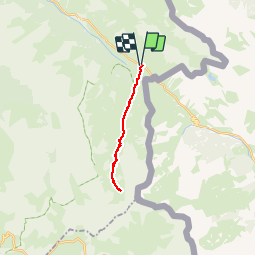

Length
17.3 km

Max alt
2450 m

Uphill gradient
651 m
Km-Effort
26 km

Min alt
1900 m

Downhill gradient
652 m
Boucle
Yes
Creation date :
2019-06-24 07:37:12.28
Updated on :
2019-06-24 14:22:44.271
5h58
Difficulty : Medium

FREE GPS app for hiking
 SityTrail
IGN / Geographical institutes
SityTrail Plus
The world is yours!
About
Trail Walking of 17.3 km to be discovered at Provence-Alpes-Côte d'Azur, Alpes-de-Haute-Provence, Val-d'Oronaye. This trail is proposed by labarone.
Description
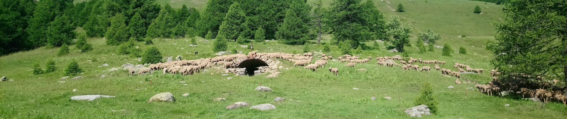
Super beau
Photos


Positioning
Country:
France
Region :
Provence-Alpes-Côte d'Azur
Department/Province :
Alpes-de-Haute-Provence
Municipality :
Val-d'Oronaye
Location:
Larche
Start:(Dec)
Start:(UTM)
331990 ; 4921560 (32T) N.
Comments