


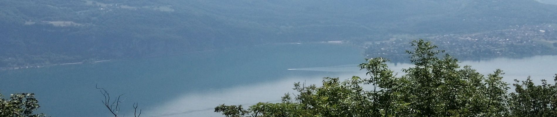
Belvédère d'Ontex le pjzt

begnez
User
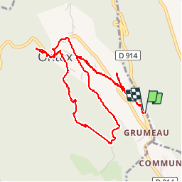

Length
6 km

Max alt
818 m

Uphill gradient
252 m
Km-Effort
9.4 km

Min alt
597 m

Downhill gradient
252 m
Boucle
Yes
Creation date :
2019-06-25 07:17:17.249
Updated on :
2019-06-25 09:11:43.752
1h48
Difficulty : Very easy

FREE GPS app for hiking
 SityTrail
IGN / Geographical institutes
SityTrail Plus
The world is yours!
About
Trail Walking of 6 km to be discovered at Auvergne-Rhône-Alpes, Savoy, Ontex. This trail is proposed by begnez.
Photos


Positioning
Country:
France
Region :
Auvergne-Rhône-Alpes
Department/Province :
Savoy
Municipality :
Ontex
Location:
Unknown
Start:(Dec)
Start:(UTM)
720242 ; 5070092 (31T) N.
Comments