


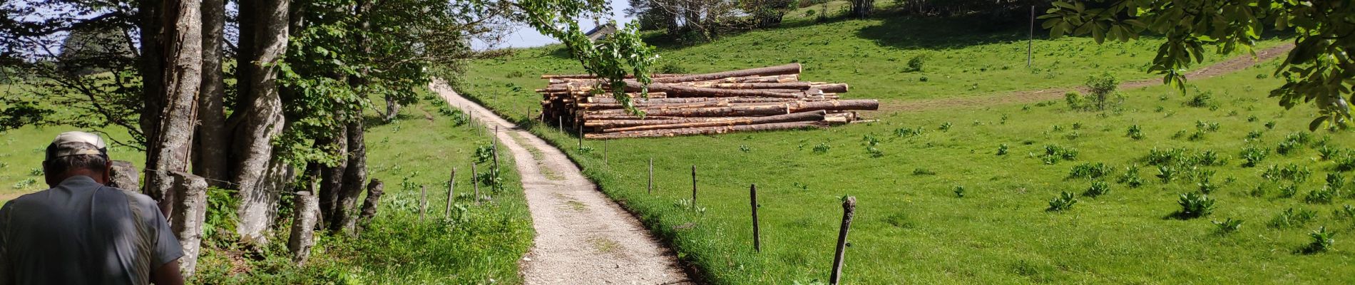
le plateau de Retord

COMAN
User
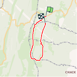

Length
9.5 km

Max alt
1282 m

Uphill gradient
216 m
Km-Effort
12.2 km

Min alt
1169 m

Downhill gradient
184 m
Boucle
No
Creation date :
2019-06-25 07:45:44.053
Updated on :
2019-06-25 12:23:24.576
3h58
Difficulty : Very easy

FREE GPS app for hiking
 SityTrail
IGN / Geographical institutes
SityTrail Plus
The world is yours!
About
Trail Walking of 9.5 km to be discovered at Auvergne-Rhône-Alpes, Ain, Valserhône. This trail is proposed by COMAN.
Photos

Positioning
Country:
France
Region :
Auvergne-Rhône-Alpes
Department/Province :
Ain
Municipality :
Valserhône
Location:
Châtillon-en-Michaille
Start:(Dec)
Start:(UTM)
711357 ; 5110082 (31T) N.
Comments