


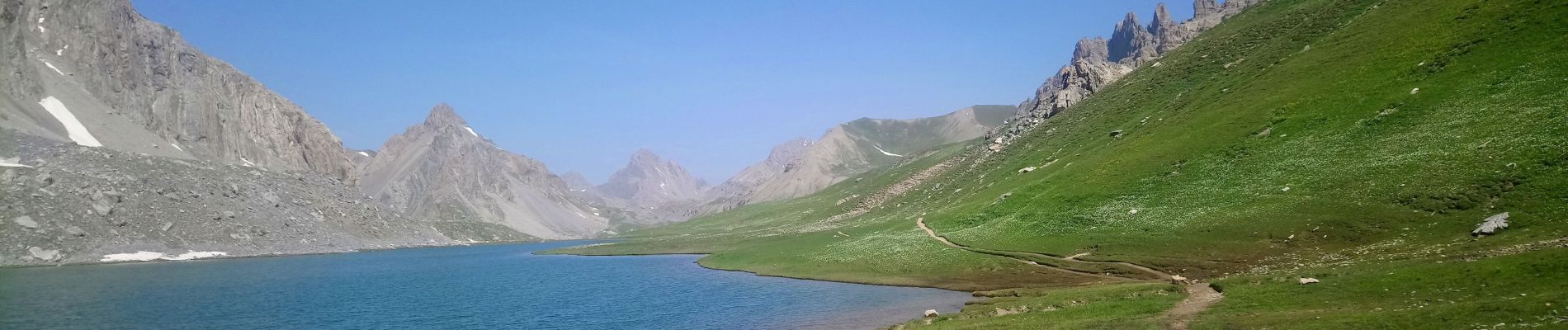
le lac de l orrenayre col de l arche

labarone
User
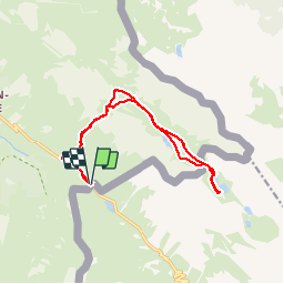

Length
15.3 km

Max alt
2508 m

Uphill gradient
706 m
Km-Effort
25 km

Min alt
1935 m

Downhill gradient
708 m
Boucle
Yes
Creation date :
2019-06-25 07:08:39.662
Updated on :
2019-06-26 07:49:12.49
5h59
Difficulty : Medium

FREE GPS app for hiking
 SityTrail
IGN / Geographical institutes
SityTrail Plus
The world is yours!
About
Trail Walking of 15.3 km to be discovered at Provence-Alpes-Côte d'Azur, Alpes-de-Haute-Provence, Val-d'Oronaye. This trail is proposed by labarone.
Description
Magnifique...
Et des marmottes...
Photos


Positioning
Country:
France
Region :
Provence-Alpes-Côte d'Azur
Department/Province :
Alpes-de-Haute-Provence
Municipality :
Val-d'Oronaye
Location:
Larche
Start:(Dec)
Start:(UTM)
332709 ; 4920911 (32T) N.
Comments