


Mont Forchat par cool du Cou en boucle - 29 juin 2019

morganee
User

Length
11.7 km

Max alt
1524 m

Uphill gradient
596 m
Km-Effort
19.6 km

Min alt
1061 m

Downhill gradient
594 m
Boucle
Yes
Creation date :
2019-06-29 09:16:29.79
Updated on :
2019-06-29 15:16:02.032
5h28
Difficulty : Medium

FREE GPS app for hiking
 SityTrail
IGN / Geographical institutes
SityTrail Plus
The world is yours!
About
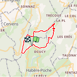
Trail Walking of 11.7 km to be discovered at Auvergne-Rhône-Alpes, Upper Savoy, Habère-Poche. This trail is proposed by morganee.
Description
belle rando, aucune difficulté, montée raide pour arriver au Mont Forchat
Positioning
Country:
France
Region :
Auvergne-Rhône-Alpes
Department/Province :
Upper Savoy
Municipality :
Habère-Poche
Location:
Unknown
Start:(Dec)
Start:(UTM)
304725 ; 5126911 (32T) N.
Comments