Trail Walking Gedinne - Vallée de la Hulle - 16 km - Photo

Vallée de la Hulle - 16 km

© OpenStreetMap contributors
Length
Length
16.1 km
Max alt
Max alt
378 m
Uphill gradient
Uphill gradient
303 m
Km-Effort
Km-Effort  
20 km
Min alt
Min alt
194 m
Downhill gradient
Downhill gradient
305 m
Boucle
Boucle
Yes
Creation date :
2019-06-30 10:02:23.33
Updated on :
2021-09-09 09:25:17.87

(0 Reviews)

Walking
Walking
4h15
Difficulty : Medium

Scan this QR Code to open this trail in the SityTrail application

FREE GPS app for hiking

Logo SityTrail SityTrail

IGN / Geographical institutes

Download SityTrail from the App Store Download SityTrail from Google Play

Logo SityTrail SityTrail World

The world is yours!

Download SityTrail from the App Store Download SityTrail from Google Play Download SityTrail on Huawei AppGallery

About

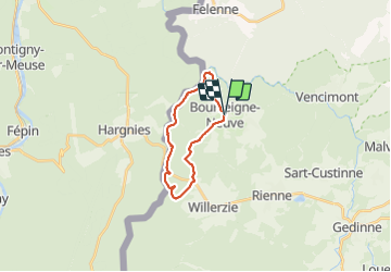
Trail Walking of 16.1 km to be discovered at Wallonia, Namur, Gedinne. This trail is proposed by Michel.G..

Description

Au départ de Bourseigne-Neuve cette boucle dans le sens horaire est vraiment très agréable, la proportion d'asphalte est très limitée. C'est une variante légèrement allongée de la version précédente, qui elle s'effectue dans le sens anti-horaire, toujours disponible  sur Sity Trail.
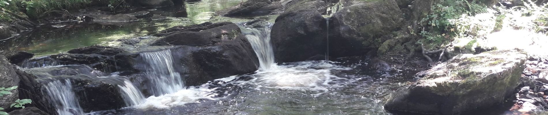
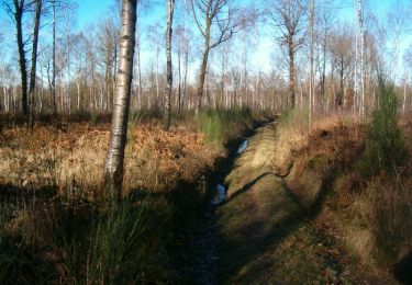
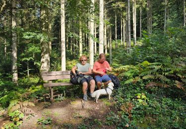
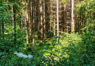
Rando pour les amoureux de la nature, faune et flore exceptionnelles, environnement époustouflant, très peu fréquenté. Un bâton de marche est conseillé pour écarté les orties et les ronces à certains endroits.
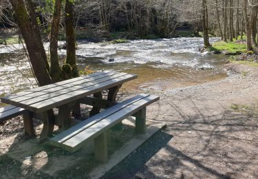
! Certains passages peuvent être très boueux et il y a un passage à gué !
Merci de laisser vos remarques!

Elevation profile

Photos

Points of interest

Point of interest Gedinne - Information - Photo
Michel.G.
GEDINNE 
Point of interest Gedinne - Information - Photo
Michel.G.
GEDINNE 
Point of interest Gedinne - Information - Photo
Michel.G.
GEDINNE 
Point of interest Gedinne - Information - Photo
Michel.G.
GEDINNE 
Point of interest Gedinne - Le Secret du Bois - Photo
Michel.G.
Point of interest Gedinne - Information - Photo
Michel.G.
GEDINNE 

Positioning

Country:
Belgium
Region :
Wallonia
Department/Province :
Namur
Municipality :
Gedinne
Location:
Unknown
Start:(UTM)
632882 ; 5543038 (31U) N.

Trails nearby

Trail Walking Gedinne - RB-Na-08 Dans la vallée de la Houille - Photo
Walking
PRO

Walking

Medium
(5)
Gedinne, Wallonia, Namur, Belgium
22 km | 28 km-effort
6h 0min
Yes
Trail Walking Hargnies - De Hargnies au Point de vue de la Roche à Fépin par la vallée du Risdoux - Photo
Walking
tracegps

Walking

Difficult
(1)
Hargnies, Grand Est, Ardennes, France
13.9 km | 18 km-effort
4h 0min
Yes
Trail Walking Gedinne - La vallée de la Houille - Rienne - Photo
Walking
GUIDE
Desrumaux

Walking

Medium
(1)
Gedinne, Wallonia, Namur, Belgium
22 km | 28 km-effort
5h 30min
Yes
Trail Walking Hargnies - De Hargnies au Point de vue de la Roche à Fépin par la vallée du Risdoux - Photo
Walking
GUIDE
Desrumaux

Walking

Medium
(1)
Hargnies, Grand Est, Ardennes, France
13.9 km | 18 km-effort
3h 20min
Yes
Trail Walking Gedinne - Balade à Willerzie - Gedinne - Photo
Walking
GUIDE
Desrumaux

Walking

Difficult
Gedinne, Wallonia, Namur, Belgium
10.9 km | 13 km-effort
2h 57min
Yes
Trail Walking Beauraing - Balade dans la forêt de Felenne-Beauraing - Photo
Walking
GUIDE
Desrumaux

Walking

Difficult
Beauraing, Wallonia, Namur, Belgium
10.5 km | 14.4 km-effort
3h 16min
Yes
Trail Walking Gedinne - Balade à Bourseigne-Neuve - Gedinne - Photo
Walking
GUIDE
Desrumaux

Walking

Medium
Gedinne, Wallonia, Namur, Belgium
8.7 km | 11.4 km-effort
2h 35min
Yes
Trail Walking Gedinne - Balade de Bourseigne-Vieille à Vencimont - Photo
Walking
GUIDE
Desrumaux

Walking

Difficult
Gedinne, Wallonia, Namur, Belgium
12.1 km | 16 km-effort
3h 38min
Yes
Trail Walking Gedinne - Balade de Vencimont à Sart-Custine - Photo
Walking
GUIDE
Desrumaux

Walking

Difficult
Gedinne, Wallonia, Namur, Belgium
11.8 km | 15.4 km-effort
5h 21min
Yes


Close
My subscriptions