


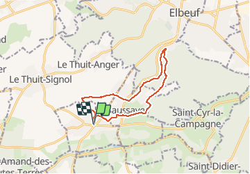
20170617-St_Pierre_des_Fleurs

doudet
User

Length
11.7 km

Max alt
153 m

Uphill gradient
134 m
Km-Effort
13.5 km

Min alt
58 m

Downhill gradient
135 m
Boucle
Yes
Creation date :
2019-07-02 06:33:01.592
Updated on :
2019-07-02 06:33:01.592
--
Difficulty : Unknown

FREE GPS app for hiking
 SityTrail
IGN / Geographical institutes
SityTrail Plus
The world is yours!
About
Trail Walking of 11.7 km to be discovered at Normandy, Eure, Saint-Pierre-des-Fleurs. This trail is proposed by doudet.
Positioning
Country:
France
Region :
Normandy
Department/Province :
Eure
Municipality :
Saint-Pierre-des-Fleurs
Location:
Unknown
Start:(Dec)
Start:(UTM)
351999 ; 5457333 (31U) N.
Comments