


20150131-la londe bn

doudet
User
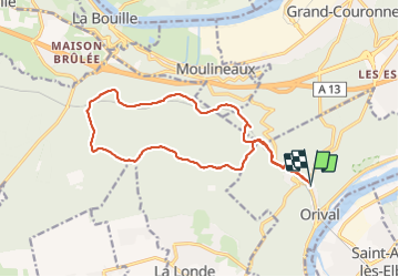

Length
15.5 km

Max alt
118 m

Uphill gradient
210 m
Km-Effort
18.3 km

Min alt
13 m

Downhill gradient
209 m
Boucle
Yes
Creation date :
2019-07-02 06:56:36.037
Updated on :
2019-07-02 06:56:36.037
--
Difficulty : Unknown

FREE GPS app for hiking
 SityTrail
IGN / Geographical institutes
SityTrail Plus
The world is yours!
About
Trail Walking of 15.5 km to be discovered at Normandy, Seine-Maritime, Orival. This trail is proposed by doudet.
Positioning
Country:
France
Region :
Normandy
Department/Province :
Seine-Maritime
Municipality :
Orival
Location:
Unknown
Start:(Dec)
Start:(UTM)
354232 ; 5464749 (31U) N.
Comments