


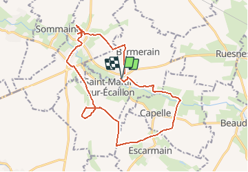
20130901-Circuit des Larris

doudet
User

Length
16.7 km

Max alt
104 m

Uphill gradient
202 m
Km-Effort
19.4 km

Min alt
46 m

Downhill gradient
208 m
Boucle
Yes
Creation date :
2019-07-02 07:06:11.479
Updated on :
2019-07-02 07:06:11.479
--
Difficulty : Unknown

FREE GPS app for hiking
 SityTrail
IGN / Geographical institutes
SityTrail Plus
The world is yours!
About
Trail Walking of 16.7 km to be discovered at Hauts-de-France, Nord, Bermerain. This trail is proposed by doudet.
Positioning
Country:
France
Region :
Hauts-de-France
Department/Province :
Nord
Municipality :
Bermerain
Location:
Unknown
Start:(Dec)
Start:(UTM)
537899 ; 5566675 (31U) N.
Comments