


20131221-pont de l'arche

doudet
User
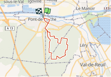

Length
11.7 km

Max alt
138 m

Uphill gradient
172 m
Km-Effort
14 km

Min alt
5 m

Downhill gradient
169 m
Boucle
Yes
Creation date :
2019-07-02 07:08:14.663
Updated on :
2019-07-02 07:08:14.663
--
Difficulty : Unknown

FREE GPS app for hiking
 SityTrail
IGN / Geographical institutes
SityTrail Plus
The world is yours!
About
Trail Walking of 11.7 km to be discovered at Normandy, Eure, Pont-de-l'Arche. This trail is proposed by doudet.
Positioning
Country:
France
Region :
Normandy
Department/Province :
Eure
Municipality :
Pont-de-l'Arche
Location:
Unknown
Start:(Dec)
Start:(UTM)
366071 ; 5463096 (31U) N.
Comments