


meclier a/r par moulin berth

RenaudCandottiBesson
User
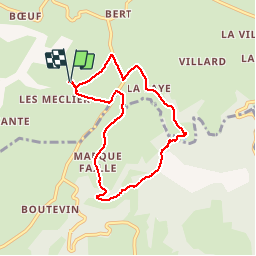

Length
7.1 km

Max alt
462 m

Uphill gradient
136 m
Km-Effort
8.9 km

Min alt
372 m

Downhill gradient
137 m
Boucle
Yes
Creation date :
2019-07-02 07:46:52.034
Updated on :
2019-07-02 09:21:42.994
1h34
Difficulty : Very easy

FREE GPS app for hiking
 SityTrail
IGN / Geographical institutes
SityTrail Plus
The world is yours!
About
Trail Walking of 7.1 km to be discovered at Auvergne-Rhône-Alpes, Allier, Vernusse. This trail is proposed by RenaudCandottiBesson.
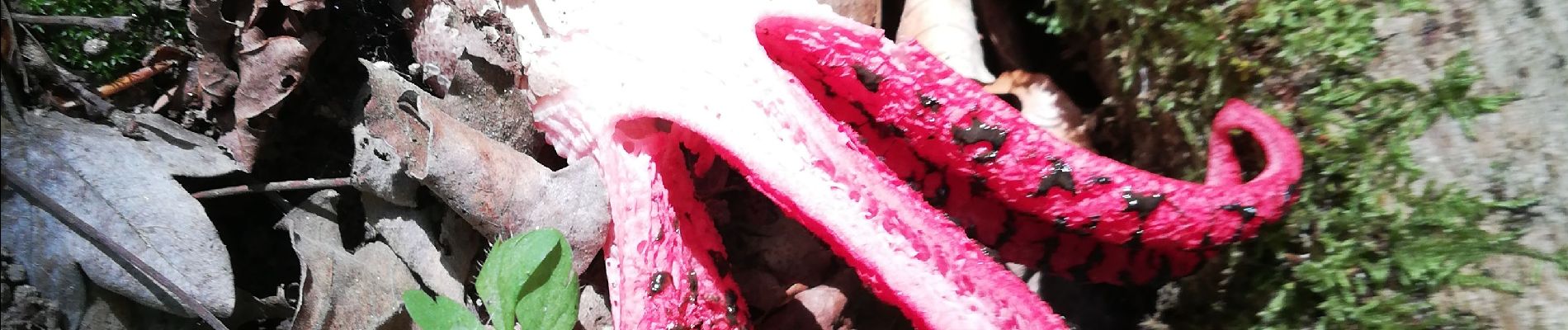
Photos

Positioning
Country:
France
Region :
Auvergne-Rhône-Alpes
Department/Province :
Allier
Municipality :
Vernusse
Location:
Unknown
Start:(Dec)
Start:(UTM)
497159 ; 5121935 (31T) N.
Comments