


20140605-gerberoix

doudet
User
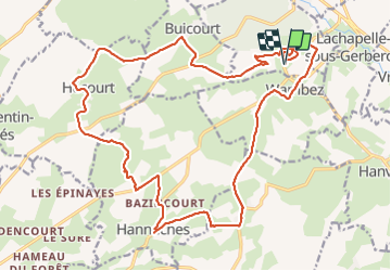

Length
24 km

Max alt
213 m

Uphill gradient
404 m
Km-Effort
30 km

Min alt
134 m

Downhill gradient
403 m
Boucle
Yes
Creation date :
2019-07-02 16:53:05.42
Updated on :
2019-07-02 16:53:05.42
--
Difficulty : Unknown

FREE GPS app for hiking
 SityTrail
IGN / Geographical institutes
SityTrail Plus
The world is yours!
About
Trail Walking of 24 km to be discovered at Hauts-de-France, Oise, Gerberoy. This trail is proposed by doudet.
Positioning
Country:
France
Region :
Hauts-de-France
Department/Province :
Oise
Municipality :
Gerberoy
Location:
Unknown
Start:(Dec)
Start:(UTM)
416667 ; 5487247 (31U) N.
Comments