


St Benoît

Arnaud Dejean
User
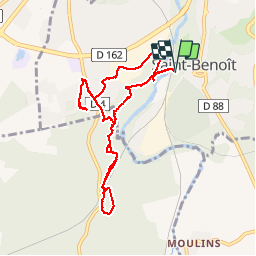

Length
9.2 km

Max alt
133 m

Uphill gradient
182 m
Km-Effort
11.6 km

Min alt
73 m

Downhill gradient
182 m
Boucle
Yes
Creation date :
2019-07-03 13:17:14.052
Updated on :
2019-07-03 17:05:41.171
2h38
Difficulty : Very easy

FREE GPS app for hiking
 SityTrail
IGN / Geographical institutes
SityTrail Plus
The world is yours!
About
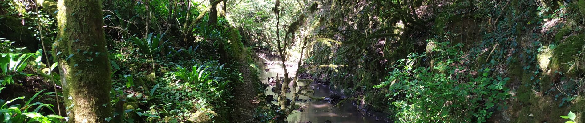
Trail Walking of 9.2 km to be discovered at New Aquitaine, Vienne, Saint-Benoît. This trail is proposed by Arnaud Dejean.
Photos


Positioning
Country:
France
Region :
New Aquitaine
Department/Province :
Vienne
Municipality :
Saint-Benoît
Location:
Unknown
Start:(Dec)
Start:(UTM)
295873 ; 5158584 (31T) N.
Comments