


refuge du lac blanc au refuge de bellachat en passant par le refuge de la flégère

dudu85
User

Length
13.1 km

Max alt
2487 m

Uphill gradient
779 m
Km-Effort
24 km

Min alt
1810 m

Downhill gradient
982 m
Boucle
No
Creation date :
2019-07-03 17:18:04.581
Updated on :
2019-07-03 17:20:19.975
5h12
Difficulty : Very difficult

FREE GPS app for hiking
 SityTrail
IGN / Geographical institutes
SityTrail Plus
The world is yours!
About
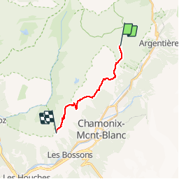
Trail Walking of 13.1 km to be discovered at Auvergne-Rhône-Alpes, Upper Savoy, Chamonix-Mont-Blanc. This trail is proposed by dudu85.
Positioning
Country:
France
Region :
Auvergne-Rhône-Alpes
Department/Province :
Upper Savoy
Municipality :
Chamonix-Mont-Blanc
Location:
Unknown
Start:(Dec)
Start:(UTM)
336704 ; 5094165 (32T) N.
Comments